Waterfront Terms for Eastern Shore Home Buyers
January 22, 2026
January 22, 2026
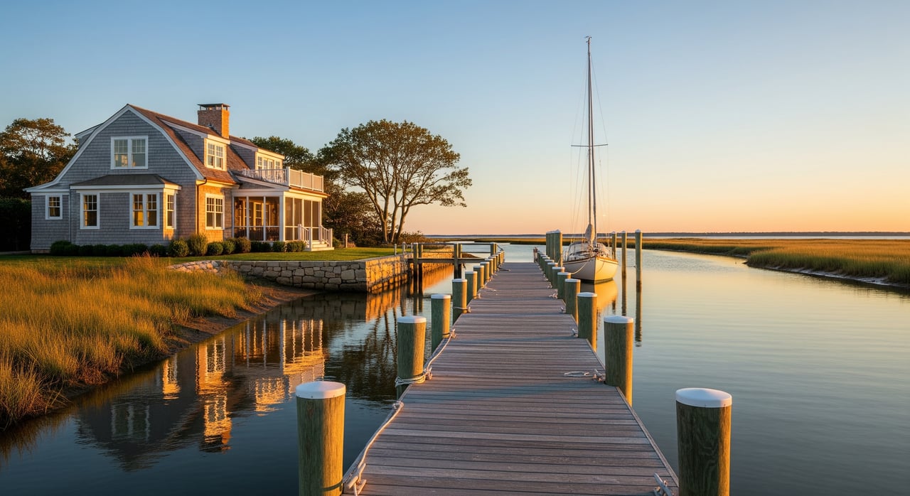
Does a listing that says “deep-water access” actually mean your boat will float at low tide? If you are eyeing a St. Michaels waterfront home, the language can be confusing. This guide breaks down common terms, the local rules that govern piers and shorelines, and the key questions to ask before you write an offer. Let’s dive in.
MLW and MHW are tidal reference lines based on long-term averages of low and high tides. Agencies, surveyors, and listing agents use them to describe depth and where structures can be built. Depth at the dock is often stated “at MLW,” which tells you what you can expect at the lowest tides.
Always ask, “What is the measured depth at MLW at the docking location?” Request a current survey that shows the MHW and MLW lines. For background on how these datums are set, review the NOAA Tides & Currents resources on tidal datums and station data.
“Deep water” is a marketing phrase, not a legal standard. What matters is the proven depth at MLW at the dock and along the route to the channel. Small powerboats may need roughly 3-6 feet at MLW. Larger yachts need more.
Confirm the channel depth, any history of shoaling, and whether dredging is common or expected. Ask who pays for dredging, whether permits exist, and if there is a recorded dredging easement or maintenance agreement.
Riparian rights are the privileges that come with waterfront ownership. They can include access to the water and the ability to apply for a pier, subject to state and federal rules. In tidal waters, the public trust doctrine applies to navigable waters and many submerged lands.
Verify what the deed actually grants. Ask whether the pier stands over private or state-owned submerged lands, and whether any shared or public access easements exist. A boundary and tidal survey can clarify MHW/MLW lines and pier location.
A bulkhead is a vertical wall at the water’s edge. Riprap is a sloped rock revetment. A living shoreline uses native plants, coir logs, and limited stone to manage erosion while improving habitat. Maryland strongly encourages living shorelines where feasible and often requires permits for hard structures.
Ask about the age and condition of the bulkhead or riprap, recent repairs, and any permits or violations. If replacement is likely, discuss whether a living shoreline is feasible with regulators. For guidance and programs, see Maryland DNR’s living shoreline resources at Maryland Department of Natural Resources and the Chesapeake Bay Foundation.
A fixed pier is supported by pilings and does not move with the tide. A floating dock rises and falls with the water level. Boatlifts need power and may require additional permits or structural capacity.
Confirm the pier length from MHW, number of slips, lift details, and the permits for each structure. Some locations limit pier length or require extra approvals if a pier extends into channels or fairways.
Dredging removes sediment to maintain navigation depths. It can be costly and may need repeating in areas that shoal.
Ask for records of past dredging, who paid, and how often it is needed. Request copies of permits and any recorded dredge easements or cost-sharing agreements. A long-term maintenance plan is a plus.
Private slips are assigned to owners, while marinas also offer transient slips. Mooring fields use buoys and have their own rules. Channels and fairways are the maintained routes boats use.
Being close to a channel can help with access, but may bring wakes or navigation rules. Ask about nearby marina policies and posted channel depths.
Maryland’s Critical Area extends 1,000 feet from mean high water and tidal wetlands. Waterfront parcels often face added setbacks, impervious surface limits, and buffer requirements. Review the program overview at the Maryland Critical Area Commission.
The Maryland Department of the Environment regulates work in tidal wetlands and waterways, including many bulkheads, piers, living shorelines, and dredging projects. Many activities need authorization. Start with the MDE Wetlands & Waterways information at the Maryland Department of the Environment.
Certain structures and dredging may require federal permits under Section 10 and Section 404. The U.S. Army Corps of Engineers, Baltimore District, handles these in our region. Learn more on the USACE Baltimore District site.
Talbot County Planning & Zoning and the Town of St. Michaels manage zoning, local permits, and records. Before you close, confirm that the pier, lifts, and shoreline work were permitted and inspected. Start your records search with Talbot County Planning & Zoning.
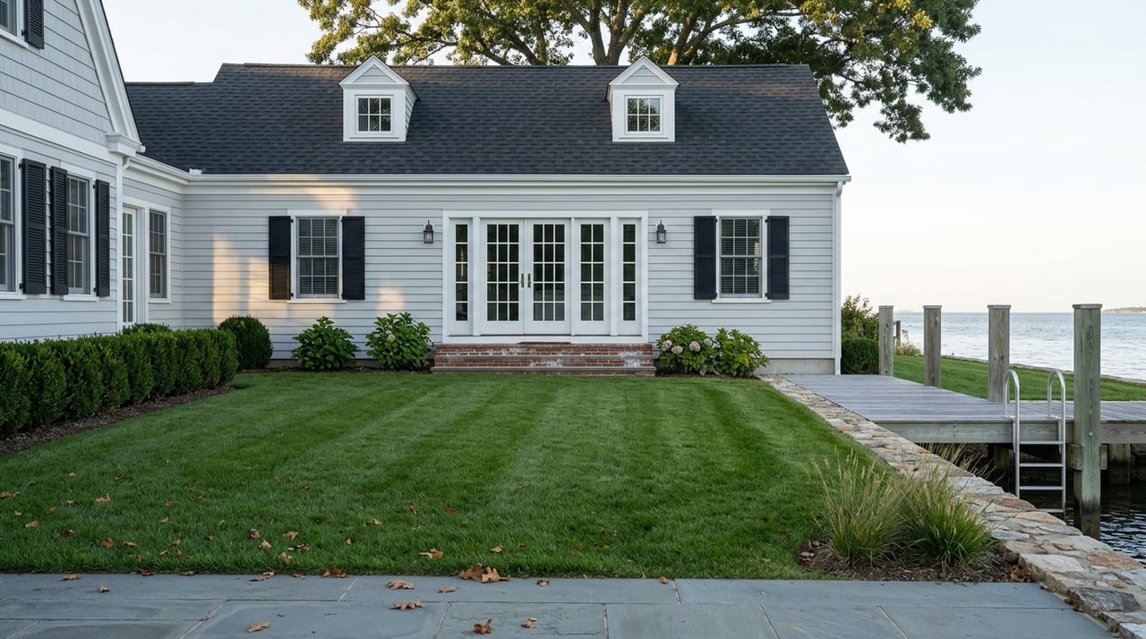
Shorelines around St. Michaels include a mix of older timber bulkheads, riprap, and newer living shoreline projects. Many older bulkheads are nearing the end of their service life and could trigger replacement permits. Private piers are common, and some community canals have shallow entrances that limit draft at certain tides.
Local tributaries and approaches can shoal. A listing that says “near deep water” may still require crossing a shallow flat at low tide. Ask for recent soundings, channel charts, or input from a nearby marina.
Dredging often requires layered approvals and cost sharing. Some neighborhoods pool resources to maintain access. Ask if a cooperative or HOA manages dredging and what future costs you should expect.
Flood risk matters on the Eastern Shore. FEMA flood zones affect insurance and building costs. Review the current maps at the FEMA Map Service Center and ask the seller about recent high-water events.
Waterfront language is only helpful if it matches real conditions and permits. With clear terms, the right documents, and local checks, you can buy with confidence in St. Michaels. If you want a seasoned local guide to help you vet access, permits, and value, reach out to Chuck Mangold, Jr. for private advice and a waterfront tour plan.


Get assistance in determining current property value, crafting a competitive offer, writing and negotiating a contract, and much more. Contact me today.